
Reviewed · WALKING TOURS
Bristol Harbourside Self-Guided Walking Tour
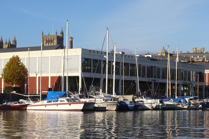
Bristol’s harbour is a history book you can walk through. This self-guided route links medieval Bristol, Georgian squares, old docks, slave-trade connections, shipbuilding, and modern waterside life, ending near Brunel’s SS Great Britain. Helen’s recorded narration gives the walk a personal voice rather than a computer-generated one.
I like the low price of $12.33 and the freedom to walk at your own pace. I also like the range of places covered, from Pero’s Bridge and King Street to Redcliffe Caves and M Shed. The main caution is navigation. One person found streets hard to identify, access blocked in places, and detours longer than expected, so keep your phone charged and allow more than two hours.
Key points to know before you go

- Helen provides the human-narrated audio: You hear a real guide, supported by photos, videos, directions, and local recommendations.
- The route covers old Bristol and new Bristol: Expect medieval churches, Georgian streets, former docks, museums, bridges, and food spots.
- Three weeks of app access gives you flexibility: You do not need to finish every stop in one outing.
- The walk is free at each stop: Your payment covers the digital guide, route, and content, not admission to attractions.
- Navigation deserves attention: Some streets may be difficult to identify, and changing access can affect the route.
- The finish near SS Great Britain is a strong finale: You can add the ship visit if you have time, though entry is not included.
What this Bristol harbour walk gives you
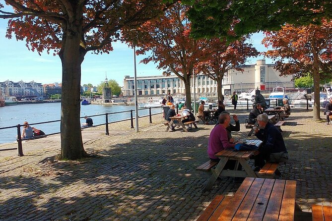
This is not a guided group stroll with a person beside you. It is a private audio walk for your own party, delivered through an app. You follow a map and GPS route while Helen explains what you are seeing.
That format suits you if you like stopping for photos, pausing for lunch, or splitting a long walk across more than one day. You receive three weeks of unlimited access, so the route does not have to be treated as a race.
The advertised walking time is about two to three hours. That is a reasonable target for the audio stops themselves, but you should allow extra time for wrong turns, blocked paths, photos, museum visits, and breaks. The route includes many short stops, often five or ten minutes, with a longer fifteen-minute pause at College Green and another at M Shed.
At $12.33 per person, the value is good if you want an introduction to Bristol rather than a full day of paid attractions. You get directions, a GPS route, audio, pictures, videos, and recommendations for less than the cost of many in-person city tours. You will still need to pay separately for any attraction you choose to enter.
More Walking Tours in Bristol
- Blackbeard to Banksy – The Ultimate Walking Tour of Bristol
★ 5.0 · 1,961 reviews - Air Raid Shelter + St. Nicholas Market Walking Tour
★ 5.0 · 1,950 reviews - Ghosts, Ghouls & Gallows :The Original Bristol Ghost Walk
★ 5.0 · 262 reviews
Millennium Square and the modern waterfront
The walk begins at Millennium Square, on the former Canon’s Marsh. This was once marshy ground where the River Frome met the River Avon. It was drained and built on in the early 18th century, which gives you an early lesson in Bristol’s constant reshaping of water and land.
This opening works well because it sets up the main theme of the walk. Bristol’s harbour is not simply a pretty strip of water. It is an old working port altered for roads, buildings, museums, public squares, and leisure.
At the Bristol Amphitheatre and Waterfront Square, the focus shifts to present-day city life. The amphitheatre is a place where skateboarders can ride, unlike parts of the city designed to prevent skating. You get a small but telling look at how public spaces are managed and used.
The stop is short, only about five minutes. Think of it as a quick orientation rather than a major attraction.
Pero’s Bridge and the medieval harbour
Pero’s Bridge opened in 1999 and honors Pero Jones, an important figure in Bristol’s local story. The pair of horn-shaped sculptures gives the bridge an unusual appearance, and Helen explains both the name and the design.
This is one of the route’s most useful stops because it connects a modern crossing with Bristol’s difficult past. The bridge is easy to photograph, but the story behind it matters more than the structure itself.
Nearby, the route reaches the approximate location of the medieval harbour, where the Avon and Frome met. Today, fountains mark the area. You can pause here and picture a much older waterfront before moving toward College Green.
The route also provides suggestions for nearby places to visit. Since the audio remains available for three weeks, you can return to this central area after exploring another part of the city.
College Green, King Street, and Queen Square

College Green is one of the walk’s longer stops, at around fifteen minutes. Here, you hear about an important abbey, artwork by a famous artist, another chapel, and a museum.
The value of this section is variety. You are not simply following the water. The walk turns inland and shows how Bristol’s religious, artistic, and civic buildings fit into the port city’s story.
King Street brings you back to commerce. In earlier centuries, ship captains, traders, and dock workers moved goods between vessels and stores here. The audio asks you to imagine that noisy working street rather than viewing it only as a pleasant historic lane.
Queen Square offers a different mood. This Georgian park is framed by trees, cobbled streets, and old houses. Before development began in 1699, the area was marshland used for rubbish dumping and weapons practice. That contrast is worth noticing: an elegant square grew from land that once had a much rougher purpose.
These stops are short, so listen closely. If you want time to examine buildings or sit in the square, pause the audio rather than trying to keep up with its timing.
Same part of England, a completely different sort of day:
- (9pm) The House Magicians Comedy & Magic Show – Smoke & Mirrors
★ 5.0 · 356 reviews - West Country Games – the most popular group activity in the South West!
★ 5.0 · 315 reviews - The House Magicians’ Comedy Magic Show at Smoke & Mirrors in Bristol (Sat 7pm)
★ 5.0 · 296 reviews - The House Magicians Comedy Magic Shows
★ 5.0 · 263 reviews
Welsh Back and Castle Park

Welsh Back has a name that invites a question. It was once a busy working area and remains a popular evening spot, with bars and restaurants, including some on boats. Helen explains what the name reveals about the area’s past.
This is a good example of the walk’s approach. Instead of giving you only dates, the audio uses street names, buildings, and everyday places as clues to Bristol’s trading life.
Castle Park takes you to the site of Bristol’s old castle and medieval settlement. Only a short amount of time is assigned here, but the location is important. It helps you understand that the modern city grew around an older fortified center.
At Bridge Quay, you get a good view of Bristol Bridge. St Peter’s, St Nicholas’, and St Mary Le Port churches appear in the background. The bridge is believed to be where Bristol’s settlement began, so this is one of the route’s strongest places for connecting the city’s beginnings with its later growth.
You may want to pause here for the view. The audio gives you the story, but the setting rewards a slower look.
Redcliffe, St Mary Redcliffe, and the caves

The route then crosses into Redcliffe, where St Mary Redcliffe Church is the main landmark. The present church is not the original building from the time of Henry I. That earlier church fell into disrepair and was rebuilt in the 14th century.
Even if you do not go inside, the church helps explain the importance of Redcliffe. It is not just a scenic waterfront district. It grew beside the port, with religious buildings, homes, workshops, and storage spaces tied to trade.
Redcliffe Caves add a more unusual stop. The district takes its name from the bright red Triassic sandstone visible here. Houses along Redcliffe Wharf were built above caves leading toward St Mary Redcliffe Church.
This is the sort of detail that is easy to miss on an independent walk. The caves are not merely an odd local feature. They show how the city used the ground beneath its streets and buildings.
The stop lasts about ten minutes. Access conditions can change, and the route has received a caution about blocked streets and unclear directions, so check the app carefully as you approach this section.
Bathurst Basin and Princes Wharf

Bathurst Basin lost its water supply when the New Cut was dug in 1809. At the entrance, the Ostrich pub dates from around 1745 and once served sailors, dock workers, and merchants.
This short section gives you a glimpse of the port’s working social life. A pub beside a basin was not simply a place for a modern meal. It was part of the daily world of people loading goods, repairing boats, and waiting for work.
At Princes Wharf, you see how completely the harbour has changed. Almost all the city docks are now closed to cargo ships. Look for physical clues to the old trade, since the waterfront no longer operates as it once did.
The route is strongest when it asks you to read the surroundings. Old dock edges, basins, warehouses, bridges, and street names can reveal more than a single preserved building.
The Matthew, M Shed, and Wapping Wharf

The Matthew of Bristol is a replica of the ship John Cabot sailed to the Americas in 1497. The replica is surprisingly small, and it crossed the Atlantic to Canada in 1997 for the 500th anniversary of Cabot’s voyage.
That detail gives you a useful sense of scale. Historical voyages can sound grand and abstract, but a small ship helps make the conditions more concrete.
M Shed is a free museum about Bristol and one of the few parts of the harbour retaining its original features. The walk allows about fifteen minutes here, but I would treat that as a starting point, not a complete museum visit. If you want to look through the displays properly, use your three-week access and return with more time.
Wapping Wharf once handled shipbuilding and repairs. In the 1800s, Bristol Docks were packed with boats loading and unloading goods. Today, the area feels far more relaxed, which makes the earlier description especially useful.
This stretch is a good reminder that Bristol’s waterfront has not merely been preserved. It has been changed from an industrial port into a place for museums, food, walking, and public life.
Ending beside SS Great Britain
The route finishes at Great Western Dockyard, beside Brunel’s SS Great Britain. The ship was built on this dock and was designed by Isambard Kingdom Brunel. It was the largest ship of its time and the first ship built using iron.
The ship’s launch in 1843 was described as the greatest experiment since creation. You do not need to accept the grand wording to understand the point: this vessel represented a major leap in ship design and engineering.
Ending here gives the walk a clear final chapter. You begin with marshland, medieval Bristol, and old trading routes, then move through Georgian development and working docks before reaching industrial-era engineering.
Entry to SS Great Britain is not included, so plan for it as an optional addition. If you have already spent two or three hours walking, you may prefer to stop for a look outside. If ships, engineering, or Brunel interest you, the finish gives you a natural place to continue.
Navigation, timing, and practical use
The route is offered in English and uses GPS, maps, directions, audio, photos, videos, and recommendations. Helen’s voice is a real human narration, which makes the guide easier to listen to than a synthetic announcement.
The main weakness is route clarity. A reported experience found some streets unnamed, access blocked, and detours that made the walk much longer than expected. That does not make the tour unusable, but it changes how you should approach it.
Download or open the directions before setting out, check the Before You Go section, and keep your phone charged. If a path looks closed, do not force the route. Use the map to make a safe detour and expect that the final distance may exceed the advertised estimate.
The tour is available every day, with the listed operating hours covering midnight to 11:30 p.m. That wide window gives you freedom to start when it suits your day. The walk is near public transportation, and most people can participate. Service animals are allowed.
Because this is a private activity, only your group takes part. That means no fixed group pace, but it also means no person beside you to correct a wrong turn.
Who should book it?
I would choose this walk if you want a low-cost introduction to Bristol and enjoy learning while you move. It suits independent sightseers, couples, families who prefer their own pace, and anyone staying long enough to spread the route over several outings.
I would be more cautious if you need flawless turn-by-turn directions or want a guide physically present. The navigation issue is important, especially in a changing urban area with blocked access.
For $12.33, the content is good value if you use the three weeks of access and add free stops such as M Shed, College Green, Queen Square, and the harbour viewpoints. Book it if you like self-guided discovery and can handle a little route-finding. Skip it if your priority is a smooth, tightly managed walk with no need to check a map.
FAQ
How long does the Bristol Harbourside Self-Guided Walking Tour take?
The expected duration is approximately two to three hours. Extra time may be needed for photos, museum visits, pauses, or route changes.
What language is the tour offered in?
The tour is offered in English.
Is there an in-person guide?
No. This is a self-guided activity, with Helen providing the audio narration through the app.
How long can I use the self-guided tour?
You receive three weeks of unlimited access to the tour on the app.
Where does the tour start and finish?
The tour starts in Bristol near Millennium Square and finishes at Brunel’s SS Great Britain at Great Western Dockyard, Gas Ferry Road.
Are attraction admission fees included?
No. The stops listed along the route are free, but admission to attractions such as SS Great Britain is not included.
Can I cancel or change the booking?
No. The experience is non-refundable and cannot be changed after booking.
More Self-Guided Tours in Bristol
- Bristol Street Art: Banksy Exploration Game and Tour
★ 3.5 · 39 reviews - Self-Guided Craft Beer Tour (Explore Old Market)
★ 4.5 · 19 reviews - Brunel’s Bristol: A Self-Guided Tour from SS Great Britain to Clifton Bridge
★ 4.5 · 11 reviews - Secrets of Bristol Waterfront: Self-Guided Puzzle Adventure
★ 3.5 · 5 reviews
Just added around Bristol
- Heathrow Airport to Bristol private taxi transfers★ 4.5 · 14 reviews
- Guided Walking Tour Suspension Bridge Clifton Splendour & City.★ 5.0 · 100 reviews
- Wine & Cheese in the Somerset Valleys – with Michelin-star lunch!★ 5.0 · 12 reviews
- Fun, Flexible Treasure Hunt Around Bristol with Cryptic Clues & Hidden Gems★ 5.0 · 101 reviews
- Brunel Guided Tour in Bristol★ 5.0 · 4 reviews
- Brunel’s Bristol: A Self-Guided Tour from SS Great Britain to Clifton Bridge★ 4.5 · 11 reviews
- The Best of Bristol Bike Tour★ 5.0 · 39 reviews
- Avon Gorge Rock Climbing Experiences★ 5.0 · 21 reviews
Walking Tours, compared.
Oxford University Walking Tour With University Alumni Guide
Read our review →
Tour for Muggles The Ultimate Harry Potter Walking Tour in London
Read our review →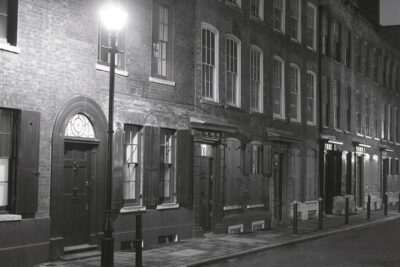
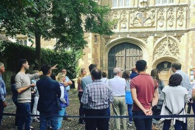
Cambridge University Walking Tour by Alumni™ Kings College Option
Read our review →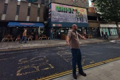
Blackbeard to Banksy – The Ultimate Walking Tour of Bristol
Read our review →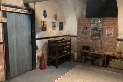
Air Raid Shelter + St. Nicholas Market Walking Tour
Read our review →
Walking Tour of Bath with Blue Badge Tourist Guide
Read our review →
Changing of the Guard Guided Walking Tour in London
Read our review →Browse the lists this tour appears in